Fife Pilgrim Way - Part 3
Lochore Meadows to Markinch
The
Fife Pilgrim Way is a new long distance walking path, following in the footsteps of medieval pilgrims coming
from Culross or
North Queensferry to see the relics of St Andrew. Over several weekends I am trying to run the route, and find out a bit about the local history on the way.
After coming from
Dunfermline to Lochore last time, this section from Lochore to Markinch brings me to a part of Fife that I am more familiar with. My wife is from Glenrothes, and going back several generations her family have lived in Lochgelly, Markinch and Balbirnie. Also it finally gives me an excuse to walk over the Cabbagehall Viaduct.
Lochgelly
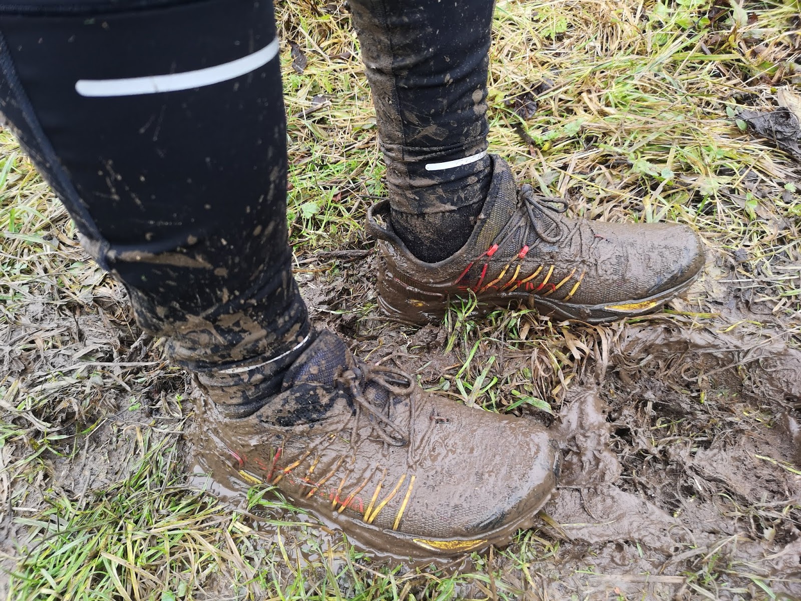
I have been running these stages of The Fife Pilgrim Way whenever I get the chance. I live in Glasgow so am relying on public transport to get me to and from different starting and finishing points. Lochore isn't easy to get to from here, so I have started 1 mile further down the road in Lochgelly, where there is a train station. The eccentricities of ScotRail's Fife Circle timetable meant that it wasn't as easy to get a few miles back down the track from Markinch as I'd imagined, but nonetheless it gave me the chance to have a quick stoat about Lochgelly. This suited me just fine as my wife's grandparents lived in Lochgelly, and it is a place that I have not been to for a while. Jimmy Herd started working down the mines here at the age of 14 and worked underground for over 50 years. He spent many years in the dangerous job of setting the explosives to break up the coal seam.
 |
| My mother-in-law as a child, a coal miner's daughter |
After Jimmy had retired in the early 1980s, and given up on blowing things up, he turned his hand to making things. He would turn his hand to anything; conservatories, garages, swing seats, and even garden strimmers made from re-purposed washing machine motors. His finest piece I think was the violin he decided to make I think than for no other reason than to see if he could, which is a thing of beauty.
 |
| Jimmy with his violin, ready for a final varnish |
Lochgelly has a longer history than some of the other mining towns nearby, already a noted town for weavers in the 1600s before iron ore and coal extraction began 200 years later. When the nearby Jenny Pit closed in 1957, and the Nellie closed in 1965 there was still plenty of work nearby for the miners of Lochgelly. Jimmy ended his working life in the Seafield Colliery at Kirkcaldy, which extended under the River Forth.
Seafield Colliery closed in 1988.
Today the only miner in Lochgelly stands in Lochgelly Square, a statue by
David Annand of a miner supporting pit props which have lines of poetry, "God The Miner", on them from
William Hershaw.
 |
| Lochgelly sculpture |
Radical Politics
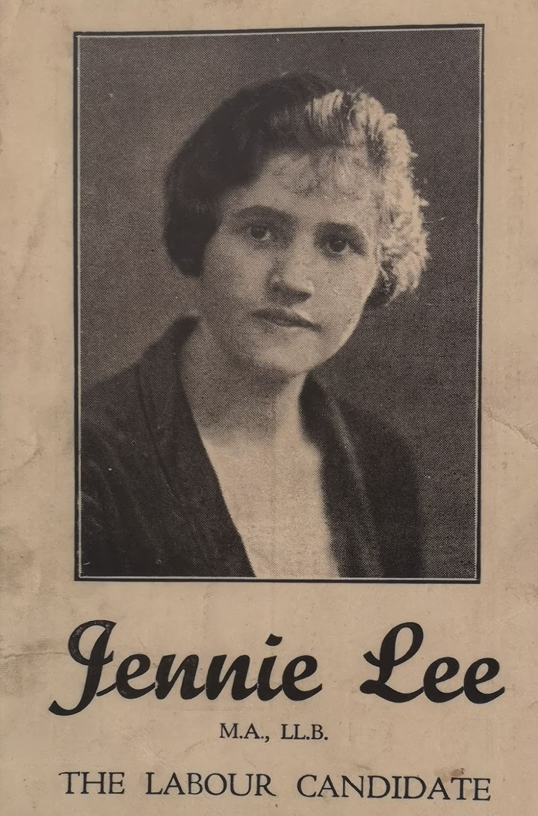
Just like my mother-in-law, another coal miner's daughter from Lochgelly was
Jennie Lee. Born in 1904 she left Beath High School and headed for Edinburgh University, initially for teacher training. She was a socialist, like several other members of her family, and her grandfather was a friend of
Keir Hardie, who later became leader of the ILP.
 |
| 1929 election card, Jennie Lee |
In 1879 the 23 year old Keir Hardie was elected leader of the National Conference of miners at a meeting in Dunfermline, and led several local strikes against mine owners who were forcing a reduction in miners' wages that year. Jennie joined the ILP (
The Independent Labour Party, the forerunner of the modern Labour Party) and was elected to parliament as their candidate in a by-election in North Lanarkshire in 1929. At that time she became the youngest MP in the House of Commons, aged 24 in an era when women under the age of 30 were not allowed to vote. Her first time in parliament overlapped with that of my great-uncle
Robert Climie, who was the ILP MP for Kilmarnock until he died in October 1929.
In 1933 she married Welsh Labour MP
Aneurin Bevin, and she was re-elected into parliament in 1945 for the Labour Party. She remained an out-spoken left-winger throughout her political career, and is most well-known for creating the
Open University in the 1960s, when she was the first Minister of State for Education in
Harold Wilson's government. The OU's goals were to offer education to those who had not had the opportunity to gain access to traditional universities. Appropriately the library in Lochgelly is now called the Jenny Lee Library.
 |
| Jennie Lee Library, Lochgelly |
At Lochore Meadows the visitor centre is named after Willie Clarke. As I write this in November 2019,
Willie Clarke has just died a couple of weeks ago, Britain's last Communist local councillor. Born in 1935 in Glencraig near Lochgelly he was a former miner, starting work when he was 14, and had been a trade unionist in the mines. For 43 years he was the councillor for Ballingry, standing on behalf of the Communist Party. In 1973, when he was first elected, there were
12 Communist councillors elected to the Lochgelly and Cowdenbeath Council. Before this West Fife had been represented in Parliament by the last Communist MP in Britain,
Willie Gallacher. He was born in Paisley and worked in the
Albion Motor Works in Glasgow. He was influenced by
John MacLean and in January 1919 was one of the organisers of a mass strike to demand a 40 hour week in Glasgow. This had sent the authorities into a panic as crowds in George Square raised the red flag. He was arrested and spent 5 months in prison at this time. In 1935 he was elected as the Communist Member of Parliament for West Fife after several previous unsuccessful attempts elsewhere. The West Fife constituency covered the area from Culross to Kirkaldy, taking in Lochgelly, Leslie and Markinch. He remained the MP for the area until 1950.
 |
| Willie Gallacher MP |
When miners'
wages had almost halved in the 7 years since the end of World War 1 a general strike was called in 1926. Although the general strike was called off by the
TUC after 9 days, many miners remained on strike for months, showing that that their unions had the power to organise over 1 million men across the whole of the UK into action. In the 1960s when many of the pits in Fife were closing down, again the miners fought against the loss of their jobs, and a delegation of Lochgelly miners marched to London in the early 1960s in protest. The coal industry in Britain was killed off in the 1980s under
Margaret Thatcher's government. The 1984 miners strike started in Fife
a month before it spread elsewhere. After a belt broke in the Frances colliery in Dysart, miners were sent home from work and the miners of Frances and Seafield collieries walked out to defend their jobs. The miners strike led by the NUM lasted over a year, and became increasingly brutal as time went on. The subsequent closure of mines in Fife led to permanent change in the communities and the landscape of this part of Scotland.
Lochgelly to Lochore Meadows
So, that's the part of the world The Fife Pilgrim Way now heads through. Trotting a mile up the road to Lochore Meadows from Lochgelly you first pass the site of the Nellie Pit, now a small industrial estate. The site of Williie Clarke's home village, Glencraig, is just along the road from here. Little of it now remains, and people began to be moved out in the 1940s to the new model village of Ballingry up the road. In 1966 Glencraig Pit closed, which led to the demise of the village. Glencraig Pit operated from 1896 to 1966 with an average workforce of 1,105 men. An information board at the side of the road here lists the names of 111 men who died in Glencraig Pit during this period. You see this again and again at every former pit, lists of hundreds of men from the region who died at their work, not to mention the many others who were seriously injured. The scale of it is hard to picture.
A football ground, Ore Park, home to Ballingry Rovers FC, and a memorial to a former resident of the village can be found here too.
Peter Johnstone was born in Cowdenbeath in 1887 and his family moved to Glencraig when his father got work in the new pit here. Peter worked alongside his father from the age of 13, and was a skilled junior footballer with several local teams. When Celtic directors saw him play for Glencraig Celtic FC against Strathclyde FC in a Junior Cup game, he was signed to Glasgow Celtic in 1908. He enlisted for the army in 1916 during World War 1, and was killed in action at the Battle of Arras in May 1917. A memorial to him stands opposite Ore Park.
 |
| Ore Park, Glencraig |
 |
| Memorial to Glencraig miner and Celtic player Peter Johnstone |
Getting back on the Fife Pilgrim Way at
Lochore Meadows, the first thing that greets you is the ruins of
Lochore Castle which stands at the entrance to the country park. The castle stood on an island until 1792 when the loch was drained. The tower that stands there now is from the 14th century, but is on the site of a 10th century crannog that once stood on an island in Loch Ore.
 |
| Lochore Castle, Fife |
 |
| Pit winding wheel, Lochore Meadows |
A former pithead wheel marks the entrance to Lochore Meadows and from here the path heads across the countryside to Kinglassie.
Kinglassie
 |
| Benarty Hill and Balingry |
Heading out from Lochore you get views back towards Benarty Hill and Ballingry, and onwards the Lomond Hills up ahead pop into view. Running along here a beautiful peregrine falcon flew just over my head, not in its high speed dive, but seemingly as curious to see me there as I was to see it.
 |
| A coo, and west Lomond appearing on the horizon |
Around Kinglassie there is much evidence of the pre-historic residents of the area. A Pictish stone,
Dogton Stone, stands in a farmer's field just south of the town, the remains of a 10th century Celtic Cross that, it has been argued, may commemorate a Pictish victory over the Danes around 900AD. When the field is in crop you cannot access it, and as I ran across the stubble to see the rock a small flock of meadow pipits rose up from the ground with their bright, chirping call.
 |
| Dogton Stone, in a field near Kinglassie |
 |
| Dogton Stone |
Churches in the town of Kinglassie can trace their history back to the 1100's, and pilgrims would stop and pray at the waters of
Finglassin's Well which lies just north of the town. This well has recently been renovated and Kinglassie has definitely decided it is going to make an effort to lay on some attractions for those passing on the Pilgrim Way. I was drawn more to the home pitch of Kinglassie FC, and the Miners Welfare Institute and bowling green next door.
 |
| Kinglassie Parish Church, with ruins of former church forming an entrance |
 |
| St Finglassin's Well, Kinglassie |
 |
| Kinglassie Miners Welfare Institute |
 |
| Kinglassie |
From 1906 to 1966 Kinglassie swelled in size when the pit here brought employment. The colliery football team started the career of some notable players. James Bowthorne played at East Fife and Dundee, and later managed Aberdeen FC. Also
Willie Fernie started with Kinglassie Hearts. He went on to play for Celtic and Scotland, and also spent some time playing at Middlesborough (he joined my team, Partick Thistle, in 1963 but left to play with Alloa without starting any games according to Wikipedia). He coached for a while at Celtic under (former coal miner) Jock Stein, before finishing his footballing career managing at Kilmarnock.
Heading past the Braefoot Tavern in Kinglassie, a former Goth pub, the path goes through the centre of town and then turns left up over a short hil towards the River Leven. North out of town, you get views towards Blythe's Folly, a tower on the hillside above the town. It was built by a wealthy linen merchant in 1812, and he watched cargo ships arriving on the Forth from it. It was used as an observation post during World War 2.
 |
| Foyle's Folly on the right, the River Forth on the left |
Leslie
The villages of Leslie and Markinch nowadays merge into Glenrothes. I have been visiting Glenrothes for almost three decades and I am always surprised when I come across the old buildings or village greens here, hiding among the concrete and roundabouts of their much younger neighbour.
The origins of the Leslie family that gave their name to the town date back to Bartolf, a Hungarian merchant who came to Scotland in the 11th century as part of Queen Margaret's entourage. He was given lands by Malcolm III in Leslie, Aberdeenshire and it is from there that the family took their name. His descendant Norman de Leslie, was given the lands of Fettykill here on the banks of the River Leven in Fife in 1283. Leslie House was completed by the family in 1672, a veritable palace according to
Daniel Defoe who visited, which burnt down in 1763. The replacement Leslie House stood until a few years ago, latterly run as a care home by the Church of Scotland. Sadly it also went on fire, a few years after the care home closed, and it now stands as an empty shell.
 |
| The chimney of a former mill, down by the River Leven below Leslie |
In the 1800s the River Leven powered mills in the town here, and at Markinch, producing lint, linen, cotton, flax and even snuff. Production increased with steam power and in 1861 the handsome Cabbagehall Viaduct brought the railway to Leslie. When the textile mills closed down paper mills replaced them here and in Markinch, Tulliss Russell being one of the largest. Now these have largely gone the way of the linen mills. Solitary brick chimneys are all that remain of some of the former mills. In the town The Bull Stone (below) stands in the village green at Leslie, behind the war memorial. It was apparently used for tethering bulls (hence the groove in the stone) when crowds assembled to watch some bull baiting. Since 1805 the sport of setting dogs against bulls has been banned, but for hundreds of years before it was a common form of entertainment.
 |
| The Bull Stone, Leslie |
The Fife Pilgrim Way then leaves Leslie and crosses the Cabbagehall Railway Viaduct, going straight through the green ribbon of the Riverside Park without ever really emerging onto the streets of Glenrothes.
 |
| Cabbagehall Viaduct, Leslie |
Glenrothes
The Riverside Park (usually known as The Town Park) is a place that I have been to many times with my children. Before that my wife grew up in Glenrothes, and was a reluctant cross-country runner in the park when at school. Glenrothes is one of the five post-war New Towns built in Scotland. (Can you name the other four? Bonus points if you know the name of the sixth one planned for Lanarkshire that was never built - answers at the bottom).
New Towns are towns laid out and planned from scratch, and are certainly not new. Construction of Edinburgh's New Town began in 1767 and New Lanark a couple of decades later. Glenrothes was part of the wave of New Towns devised as a response to overcrowding and dilapidated housing in some British cities post-World War 2. It is now home to almost 40,000 people. It was designed to house workers for the newly established
Rothes Colliery, officially opened by the Queen in 1958 in one of the most incongruous photo opportunities ever.
 |
| The Queen blending in with the local on her visit to Rothes Colliery in 1958 |
As had been predicted by many older miners in Fife the pit was not a success and was forced to close in 1964 due to geological faults and unmanageable flooding. Electronics and manufacturing industries moved into the town to join the paper mills at Leslie and Markinch as the main employers.
 |
| Irises by a roundabout in Glenrothes |
Going through Glenrothes much public art is always on display. Some of it may be familiar to Glaswegians like me, such as the sculpture of irises above that sit by a roundabout. They were built in 1988 as part of Glenrothes's contribution to the
Glasgow Garden Festival by the town artist at the time,
Malcolm Robertson, and afterwards returned home. Glenrothes took an original approach to creating a sense of identity for its residents in the 1960s by appointing a "
town artist". It was such a success that it is a model that has been copied around the world. Often working with the same materials that had been used to build the housing and being inspired by local history (such as "The Henge", a row of concrete standing stones) these pieces of public art are often humorous or involved input from local residents and schools. The first town artist,
David Harding, later went on to develop the department of Enviromental Art at Glasgow School of Art which has since produced several Turner Prize winning artists.
 |
| Concrete hippos at a pond in Glenrothes Riverside Park |
 |
| Hippo going to inspect a newly created labyrinth in the grass |
Within Riverside Park one of the hippos appears to be ready to try walking around a newly created labyrinth. This was the idea of
St Columba's Parish Church in the town, inspired by the labyrinth in
Chartres Cathedral. Labyrinths have often featured on pilgrimages, and the idea is that you walk your way slowly around the whorls, quietly praying or contemplating.
At Balfarg the path crosses through an area of housing before heading into Balbirnie Park. Here it takes the chance to pass some art work from the people that lived hereabouts 6000 years ago, Neolithic farmers who were spreading across Fife.
Balfarg Henge is a curious structure, incongruously sitting amongst a suburban housing scheme. There are two upright stones that would have once been part of a larger circle, and a 60 meter diameter ditch surrounding them. Stakes mark out the positions of timber posts that were discovered at excavation. Cremation goods and a later burial from 2000BC have also been found here. I quite like the idea of contemporary families living and playing amidst the evidence of their ancestors, rather than all our history being put up upon a special pedestal marked "Do Not Touch".
 |
| Balfarg Henge |
Just around the corner in Balbirnie Park lies the Balbirnie Stone Circle, which was moved to its current site when a road was widened nearby. It is thought to have been a site of ritual and burial, and had a hearth at the centre.
 |
| Balbirnie Stone Circle |
Markinch
The path then skirts past Balbirnie House and out from Balbirnie Park into the town of Markinch.
Balbirnie House was built from 1777 by the Balfour family who had made the estate their home since 1640. Arthur Balfour, who was Conservative Prime Minister from 1903-1905 and drew up the
Balfour Declaration in 1917, establishing a Jewish homeland in Palestine, is a relative of these Balfours. Nowadays Balbirnie House is a popular hotel and wedding venue. The family made their money here from agriculture and mining interests.
 |
| The Stob Cross, Markinch |
As you emerge onto the road to Markinch, above you sits the ancient
Stob Cross, a weathered stone cross, thought to be Pictish. The signs into town declare Markinch to be "
the ancient capital of Fife" and it was thought to be the centre of power in Fife in Pictish times, when 1000 years ago there was a substantial Pictish settlement here. Iron Age agricultural terraces cut in the hillside above Markinch show that people had lived here long before then. In the 12th century the arrival of feudal rule in Scotland led to Balbirne and Markinch being laid out as feudal estates, gifted in return for allegiance to the king.
Markinch Parish Church has a Norman tower incorporated into it, which dates to at least 1130.
 |
| Markinch Parish Church |
By the 14th century Markinch was in decline as a centre of religion and power. In the Industrial era workers came to dig coal here and on the Balbirnie estates, and the River
Leven powered corn mills, and later linen and paper mills. In the 20th century Haig whisky was one of the biggest employers here, with their huge bottling plant still standing on the edge of town. The history of mining in the town is old though. A gravestone that I saw at Markinch Parish Church marks the grave of Janet Forret, who died in 1785 aged 62. It says it was erected by her husband, a "coal hewar in Balbirnie", a pair of crossed bones on the back of the gravestone.
 |
| Grave of a "coal hewar"'s wife 1785 |
As well as Lochgelly miners on one side of her family, my wife has miners down another branch of her family tree too. The picture below is of Henry Wyse. He was born in Markinch in 1875 and later lived in Lochgelly where he worked as a miner. His father, and grandfather before him were miners in Markinch, and in the late 1700s their parents before them had come from Collessie to Markinch for work. Henry's mother was a mill worker in the town. Other Markinch relatives were employed in the Balbirnie estate, one looking after the horses, another employed by the Balfours as a wet nurse.
 |
| Henry Wyse, Lochgelly miner, born 1875 in Markinch |
The Fife Pilgrim Way begins heading away from the major Fife coalfields now, into more agricultural land. The next stage is from
Markinch to Ceres...
(NB New towns of Scotland- East Kilbride, Cumbernauld, Livingston and Irvine. Also planned but never built was Stonehouse in Lanarkshire)
Fife Pilgrim Way Links


