Friday, 7 November 2025

When Hillwalking became Munro Bagging

When I stand on the summit of my final Munro this week, I am expecting a familiar blast of wind and rain in my face obscuring any views, before taking a quick selfie and getting ready to head back down through waterlogged peat bogs. The Munro summits haven't all been like that of course, but in these days of Instagram-ready photo opportunities, I feel that it is important from the get-go to be honest that a lot of the time this is exactly what you can expect. 

In Scotland we have the right to responsible access to all of the land, a right people campaigned hard for many years ago. Taking advantage of that to the full has led to me zig-zagging across the country climbing Scotland's highest peaks. I have loved every minute of it.

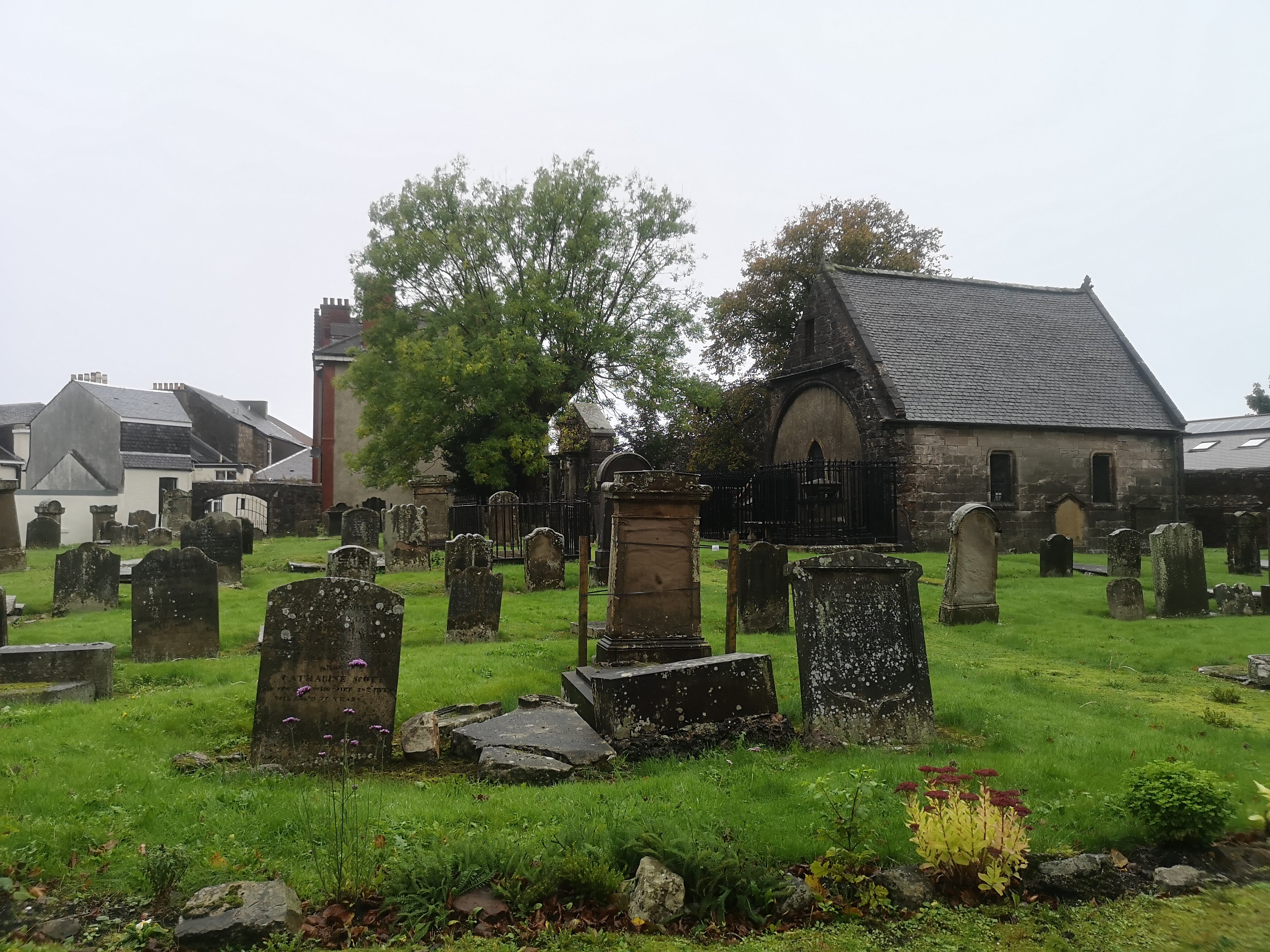
An inquisitive deer, in Glenfinnan

What are the Munros?

The Munros are a list of the Scottish mountains higher than 3000 feet in altitude, a list first drawn up in 1891 by Sir Hugh Munro. The list has been redrafted a few times as heights have been more accurately measured, and the interpretation of these being the highest peaks, separate and apart from any immediately adjacent summits changes with time. This means that the current list, maintained by the Scottish Mountaineering Club, currently stands at 282 summits. For the obsessives and pedants the complete list of summits over 3000 feet includes the 282 Munro summits plus a further 227 "Munro Tops", subsidiary peaks close to a higher Munro. Someone who has reached all 282 Munro summits is called a Munroist, or a Compleater. The archaic spelling is used, as found in e.g. the 1653 book The Compleat Angler

Finishing all 282 of Scotland's Munros is an achievement that will test your endurance and resolve, and it will absolutely test the patience of your friends and family. Even when not away on a walk, your time will be filled poring over various weather forecasts or route suggestions, planning the next trip. From Ben Hope in the north, Ladhar Bheinn the most westerly Munro on the mainland, in Knoydart, Ben Lomond to the south, and Mount Keen in the east, it is a great way to see all corners of Scotland north of the central belt. And then of course there are the islands, with 12 Munros on the Isle of Skye, and Ben Hope on the Isle of Mull. 

1980s hillwalking gear, in the Kilpatrick Hills


I have been hill-walking for 40 years, ever since some school friends and myself used to hitch-hike up Great Western Road on weekends and summer holidays, seeing where we could get to. Like many people in Glasgow we started off in the Kilpatrick Hills and the Campsie Fells just outside the city, before graduating to Ben Lomond and the Arrochar Alps, the steep, rocky mountains at the head of Loch Fyne such as Ben Ime, Ben Vorlich and the Cobbler. We walked the West Highland Way a few times in the days when you could camp anywhere along the route, and this introduced us to the mountains in Glen Coe, and to Ben Nevis near to the end point of the West Highland Way in Fort William. In those pre-internet days we were researching planned trips from books, and borrowing OS Maps from the library. The West Highland Way book at that time came with a good map that had enough hills on either side of the route to let you use it for further trips along that strip. This meant that some of the routes that we devised were a bit unconventional, joining up peaks along easier looking contour lines on the maps, but it was how we learnt to navigate. When I was 17 years old I got my first car, and Glen Etive and Glen Coe were our usual targets in those days.

Glen Etive and my pal's lovely classic Vango tent

Hillwalking with Diabetes

One challenge that I have had when hill-walking is that when I was 17 years old I was diagnosed with Type 1 diabetes. In the 1980s this meant drawing up and mixing insulins for twice daily injections. Living in Scotland cool bags were never going to be necessary on our camping trips to keep the insulin fresh, but the early blood glucose testing strips were pretty tiresome. After two minutes you had to compare the coloured strip with the side of the bottle, to get a rather vague idea of what your sugar levels were doing. The large drop of blood these strips required is easy enough to extract in a warm room, but harder to get out of cold fingers on a Scottish mountaintop. My friends always knew how to deal with me, and what the signs were of my likely hypoglycaemia if I hadn't noticed it yet. On our first walk up Britain's highest summit, Ben Nevis, I was unfortunately ignoring their advice, obstreperously refusing to take the Mars bar they were trying to force upon me because "I can't eat those fucking things, I'M DIABETIC!". 

First time up Ben Nevis

We did make it to the top, and thankfully the technology for managing diabetes has advanced in leaps and bounds. Electronic glucometers have come along requiring less time and less blood to work, then we now have continuous glucose monitors, that I have stuck into my arm nowadays, that send a continuous message to my mobile phone to let me follow my blood glucose. Syringes and insulin vials were replaced by pre-filled injection pens, and I now use an insulin pump that is permanently stuck onto me, communicating with my glucose monitor to make dose adjustments. No longer do I have to unwrap layers of clothing to expose a bit of flesh for an injection in the middle of a gale, I can dial up the dose on an app to deliver the insulin that way before I take my sandwiches.

Exercise affects different people with diabetes in different ways. With me, prolonged steady exertion makes my insulin have a much bigger effect on my blood glucose, meaning that I have learned to start those days with a blood glucose level a bit higher than I normally would - either a larger than usual breakfast, or a lower insulin dose with that meal. There is also evidence that starting exercise within two hours of an insulin bolus increases the risk of low blood sugars, so again that is something that it is better to avoid. Then when I am walking I will need to keep an eye on my blood glucose levels and snack regularly through the day. For me that means about three Jelly Babies (15g carbohydrate) every couple of miles. Alternatively I have found it helpful to have a high carbohydrate snack once I reach a summit, such as a slice of fruitcake with a cup of coffee. 

Lots of other things can affect your blood sugar, so I always overdo it with regards to how much food I carry with me, and a high carbohydrate lunch is essential on a long day, made up of things like sandwiches, biscuits, dried fruit or flapjacks. Also lots of sugary snacks for emergencies. Kendal mint cake is a compact sugar kick, and macaroon bars, the nearest Scottish version (basically potatoes and sugar covered in desiccated coconut) are always handy to carry. Those do taste better than I am making them sound.

If I am camping for a few days, the food packing becomes like planning a military operation. I find a lot of the expensive, lightweight, freeze-dried camping foods focus more on their protein rather than carbohydrate content, and usually have an unpleasant sludgy consistency. When camping I tend to carry rye bread, which is compact and less easily crushed than white bread, and has a lower glycaemic index meaning a steadier increase in blood sugar levels. A tube of Primula cheese spread or Princes meat paste, and that's your lunches sorted. The small plastic pots of Creamed Rice Pudding are handy, and I find the pouches of lentils and grains available cheaply in any supermarket (eg by Merchant Gourmet, and Lidl do good ones too) easy to carry and quick to heat up on a camping stove. 

Everybody with diabetes will react differently to exercise and to different foods. I only include these details here as ideas for other people to consider, but an element of individual trial and error is involved. 

The other thing with diabetes is that you need to look after your feet, due to the higher risk of foot ulcers and infection. So no blisters allowed. For that reason I spend a bit of time and effort seeking out well-fitting boots. Personally I always find it easier to maintain a good pair of leather boots, and keep them waterproof. 

The type of place where getting a drop of blood
from your finger can prove challenging

Becoming a Munro Bagger

About 3 years ago I morphed from being a hillwalker into a Munro bagger. I didn't ever plan to catch them all, but I kind of fell into it after being released from Covid lockdown. At that time I started looking for more remote mountains to walk in, still feeling a need to keep my distance from other people as I work in the health service where we were still being exposed to the virus. Like a potential plague carrier I was trying to keep away from the more popular mountain routes. 

When I had a short break with my family up in Achiltibuie in early 2022, as is often the case, I deserted them one day and walked up the nearby Stac Pollaidh on that trip. Although at 1600 feet this beautiful peak is not a Munro, while I was there my daughter bought me a wee Munro log book in the bookshop in Ullapool. Looking through this book, ticking off the mountains within it which I had already climbed I was surprised that I had actually climbed less than I thought, about 40 of them. These were all generally within 90 minutes drive of Glasgow, and I had been up and down the same mountains several times. In winter and in summer, in rain, snow and occasionally in sunshine, in proper gear, and (in earlier days) in denims and trainers. I had my favourites, such as Buachaille Etive Mòr and Ben Lomond. I had some, such as Schiehallion, that I climbed 5 times before I ever did it on a day when the clouds cleared and I was actually able to enjoy a view. There were also some areas that I had never done any hillwalking at all, such as in the Cairngorms. 

Buachaille Etive Mòr

I still did not think that I was planning to do them all, but once I had been handed a list I inevitably enjoyed ticking them off. In the high Cairngorms plateaux you can manage a round of four or five peaks without much ascending and descending. The Ring of Steall in the Mamores traverses four Munro summits in one 10 mile walk. Then a day spent walking along the glorious South Glen Shiel Ridge means that you have reached seven Munro summits in a single day. Quite quickly the numbers rise and it begins to look achievable. Once your friends and family notice you may be gifted a few mountaineering books and a scratch-off map of Munro summits (I got two). You then have another visual list to work through. You start to see the points on your map within the excellent Walkhighlands website turning from red to blue, the small rewards that feed your addiction start to kick in. So instead of having walked 40 Munros, I quickly reached 100 Munros. Then 150 became achievable. Once I reached 182, there was "only" 100 left to go.

I knew that I had some challenges ahead. I tend to go walking alone. For me it is a fabulous way to unwind and think about where you are putting your next footstep, rather than fretting about the day to day worries of life. Usually walking alone meant that I wanted to be better prepared for some of the exposed ridges ahead. I booked myself onto a scrambling course at Glenmore Lodge at Aviemore, and then the next weekend took myself off along the Schoolhouse Ridge at Ballachulish to tackle Sgòrr Dhearg and Sgòrr Dhòuill.

Sgòrr Dhòuill, above Ballachulish

This opened up a list of some of the more challenging Munros I had been avoiding, but there were still the 12 Munros on the Isle of Skye, particularly the 11 on the Black Cuillin Ridge that definitely required a bit of climbing. You can't complete a round of the Munros without facing this. I took a week off work in May this year, and with fingers crossed that the weather gods would smile upon me I booked a guide to help me traverse the Cuillins. (Many guides are available but I used Abacus Mountain Guides, as they are involved in training other guides, and I would highly recommend them.)
 
The Cuillin Ridge, viewed from Elgol on the Isle of Skye
In amongst the Cuillin summits

In preparation I started attending an indoor climbing wall, and took a two session beginners course in roped climbing at The Climbing Academy's Prop Store in Maryhill. This meant that when I came to the Cuillins I was confidently able to tie myself on to a rope and had a basic understanding of what was required. With four nights booked at the Glenbrittle Campsite I knocked it off with the weather. Unbroken sunshine, blue skies, and next to no wind meant plenty of midges at the campsite, but dry rock and glorious views across the sea to the islands lying below us once we were up on the gabbro rock of the Black Cuillins. Climbing the resplendently named Inaccessible Pinnacle (the "In Pinn") had been something I had imagined as completely impossible ever since I was about 14 years old and we used to joke about doing it when we started hillwalking. It was an absolute joy to actually manage it, and to then have my first go at abseiling to descend from it. 

The Inaccessible Pinnacle on Skye

Abseiling off the In Pinn

Once I had overcome all the most difficult mountains it was the practical aspects of getting to the remaining mountains that became a challenge. A few days in Gairloch with my wife was meant to give me the chance to tackle the Torridon mountains, but absolutely miserable weather meant we instead enjoyed being tourists again in a part of Scotland we had not visited together since we were students. 

Ben Hope in Sutherland is nearly 6 hours drive from where I live in Glasgow, and once I had got there I was not for coming back another day. So it was attacked in gale force winds and horizontal rain. Weather forecasting websites became my most visited sites. I find the Mountain Weather Information Service useful for planning ahead and its "chance of cloud free Munros" a helpful indicator. The Met Office mountain forecasts tend to be best for predicting summit conditions as these, such as wind speeds, can often be very different from nearby sea level conditions. The Norwegian weather site is helpful in providing actual numbers for expected rainfall or snowfall, which I find more helpful than just one, two or three raindrops shown under an image of a cloud on other websites, although its summit wind speeds are always wildly inaccurate.

There is also some logistics required in reaching for example the three Munros in Knoydart. Without any road access it either involves a long walk in, or the more enjoyable ferry in from Mallaig. I had this all lined up for a relaxed long weekend at the start of August, but as Storm Floris approached I had to get around these mountains in a forced march to catch the ferry back to Mallaig a day earlier than planned. Thankfully I made it as there were no ferries the following day and staying another night in a tent as I had intended would have been foolhardy.

Camping on Knoydart, before the storm

The final summit

There comes a point where you have to decide what is going to be your final Munro. Most people will aim at a single peak which is quite isolated, and Ben More on the Isle of Mull has been a popular choice. Taken by the easiest route it presents no particular difficulties, but unless you live on Mull, it is going to involve an overnight stay for most people. This makes it a good choice to celebrate completing (or is it compleating?) your round. In the last few months I have got through the remaining mountains quicker than I had expected, and impatiently unwilling to leave it until the surer weather of next springtime I arranged a few days off work in November to get over there. The other reason that I wanted to have Ben More as my final summit is that I have been staring at a print of Samuel Peploe's painting "Ben More from Iona" on my wall for the past 25 years. I bought it in Kirkcaldy Art Gallery's gift shop after seeing the original there: they have a very fine collection of paintings by the Scottish Colourists. It has been in every house I have lived in since, in an over the top gold frame that used to hold a postcard with Rembrandt in it.
Samuel Peploe's Ben More from Iona

So this weekend we came to Mull to tackle Ben More. CalMac tried to thwart us by cancelling our ferry, but we made it. Despite the low cloud and high winds meaning views from the top were not going to be happening it was with a sense of relief rather than excitement that I completed my Munro round. A curry in The Spice of Mull, and a night in The Mishnish lie ahead.

A beach on the Isle of Mull

A toast from my grandad's hip flask
at the top of Ben More

What comes next?

Having completed all of the Munros I am looking forward to not following a list. I have already gone back to visit a few that stood out on my first time around. Last week I enjoyed going back to The Mamores above Kinlochleven, re-visiting two summits that were a bit of a trial last time. I had twisted my knee on the second day of a three day trip and limped over the final summits of that trip growling and grimacing. There are also a few mountains that I have already planned to approach in the new year on a different route from last time, and a few that I would like to see in better weather. 

I have absolutely loved the way it has cajoled me into visiting parts of the country that I would probably not have seen otherwise. It has pushed me to learn new skills, as well as been a great incentive to maintain my fitness. When not hillwalking I regularly go running to maintain my stamina, and I will keep that going as well, with applications in for a couple of hill races in the coming months. I have already reached 72 of the 227 Munro Tops in reaching the Munros, but have no great urge to visit the remainder. Of course there are the Corbetts, the 222 mountains in Scotland between 2500 feet and 3000 feet. This is a mixed bag of rocky mountains and grassy hillocks and I think I would enjoy picking and choosing from this list rather than feeling an obligation to tackle them all. I have already been up Clisham, the Corbett in the Outer Hebrides earlier this year, and Askival and Ainshval on Rum would be an excuse to visit an island that I have not been to before. 

You can also register your name with the "Clerk of the List" maintained on behalf of the Scottish Mountaineering Club, a record of Munro Compleatists. With the Reverend A.E,Robertson in 1901 being the first, the official list now contains 8190 names. Will I bother to do that? Of course I bloody will, although I am not sure that I would ever wear the official pin badge of tie that I can purchase. 

The main thing I would take away from this is that we should all take advantage of the right to roam that we have in Scotland. To quote Woodie Guthrie, this land was made for you and me. So go and explore it. 

When you're going hillwalking in the morning, and you've got a Bryan Adams gig to go to in the afternoon. Circa 1990

Monday, 30 May 2022

Scotland v Ukraine

Scotland v Ukraine


After being postponed due to the Russian invasion of Ukraine and the ongoing conflict, on Wednesday 1st June 2022 the Ukrainian national football team will come to Glasgow to play their football World Cup qualifying match against Scotland.  

Although it is trite to say it, there are some things more important than sport. The brutal war in Ukraine is resulting in the daily deaths of many soldiers and civilians, and the demolition of cities. Despite that background Ukraine are keen to get this football match played. While the Russian football team is now banned from international competition, this match and the subsequent World Cup allow Ukraine to stand on the world stage. Just as they did at the Eurovision Song Contest, Ukraine will have great public support from around the world, while Scotland's best chance of World Cup qualification for decades is in danger of turning us into Sam Ryder, the underdog who has to smile while feigning pleasure in coming second.

Ukraine football strip for Euro 2020 competition
Sport has always been political and it is impossible pretend that it happens in some sterile bubble. Whether your players are taking the knee, wearing a poppy on their shirt or displaying an expression of national identity by playing at all. Football teams stand by their flag, wear national colours and symbols, respect their national anthem (even if opposition fans don't always). The fact Scotland still plays as a national football team despite not being an independent nation for over 400 years is a statement of how we see ourselves. In the Euro 2020 competition the Ukrainian team wore a strip that featured an outline of Ukraine, but an outline that contained Crimea, which was annexed by Russia in 2014, and Donbas and Luhansk where Russian backed separatists had been fighting at that time. "Glory to Ukraine" was printed along the back if the collar, though UEFA banned "Glory to the Heroes". Benign enough statements to an outsider but complicated by their meaning in the first nationalist movements in Ukraine in the 1917-21 war with Communist Russia, and their later adoption by various Ukrainian groups. 

The prize for the winners on Wednesday night is a further play-off against Wales, and then qualification to the World Cup in Qatar. In the most obvious way this World Cup allows FIFA to accept large quantities of money from an oil rich state, and Qatar to sanitise its image in front of a global audience. The shiny infrastructure will be on display, but stories of the deaths of possibly thousands of migrant workers will continue to be suppressed. Money talks. If you can afford to pay the thousands of pounds you can go online now and buy your quarter final package through national carrier Qatar Airways, all bundled up with 4 nights hotel accommodation and your flights. This doesn't feel like the carnival of football that previous World Cups have been.

Scotland v Brazil, France 98

Recent Form


The Ukrainian nation came into being with the collapse of the USSR in 1991. The national football team played their first international matches in 1992, losing their first ever game 3-1 to Hungary. 

Since then they have been two steps ahead of Scotland as far as qualifying for major tournaments. They qualified for the 2006 World Cup in Germany, getting as far as the quarter-finals before being eliminated in a 3-0 defeat to Italy. 

As co-hosts (with Poland) of Euro 2012 they qualified automatically for that competition, but failed to progress from a group that contained England, France and Sweden. Their final game in the competition was at the Donbass Arena, in Donetsk, where Wayne Rooney scored the only goal of the game for England. 

Ukraine qualified for Euro 2016 in France via a play-off, but lost all three of their games at the finals, against Poland, Germany and Northern Ireland. 

Scotland made their first appearance at a major tournament at Euro 2020 for a generation. Whilst Scotland only picked up one point from their three games and were eliminated, Ukraine got to the quarter-finals again, knocking out Sweden on the way, before eventual tournament losers England, beat them 4-0 in Rome. 

Previous Scotland v Ukraine Matches


Scotland and Ukraine have met twice before in competitive matches, when they were drawn in the same qualifying group for Euro 2008. In a group that also contained Georgia, Lithuania and (of course) the Faroe Islands it was France and Italy that qualified. 

The first match between Scotland and Ukraine was played at the home of Dynamo Kyiv in October 2006. While Ukraine were managed by legendary player Oleg Blokhin, Walter Smith was in charge of Scotland. With Andriy Shevchenko and Andrij Voronin leading the line for Ukraine there was much to make Scotland nervous. Oleksander Kucher scored his first goal for Ukraine on the hour, before Shevchenko finished off the tie with a penalty in the 90th minute after Steven Pressley received a red card for bringing him down in the box. 2-0 to Ukraine. 

In 2015 Oleksander Kucher would receive the quickest red card in Champions League history, being hooked for fouling Thomas Muller in the box when Shakhtar Donesk took on Bayern Munich, a game which Bayern won 7-0. 

The Scotland team that was defeated that day is noteworthy for the amount of middling future football managers that were playing that day: Graham Alexander (currently managing Motherwell), Robbie Neilson (Hearts), Steven Pressley, David Weir, Gary Caldwell, Barry Ferguson, Paul Hartley (Cove Rangers). Only James McFadden, Kenny Miller and Craig Gordon from the starting eleven haven't yet decided they've got what it takes for management, although to be fair Craig Gordon is still playing.

Oleg Blokhin

Although the three points dropped in Ukraine would later cost them qualification, the Scotland team at that time were playing with great confidence, and James McFadden's goal had earned a famous victory over France in Paris before the return fixture in Scotland against Ukraine. Scotland arrived at Hampden having won five games in a row, desperate to make it six. I attended that match at Hampden in October 2007. Alex McLeish was in charge by then, and within 10 minutes Scotland were 2-0 up with goals from Kenny Miller and Lee McCulloch. Shevchenko poked one in before half time to make it 2-1 to Scotland, but James McFadden wrapped up the three points to make it 3-1 to Scotland in the second half. 

Dinamo Kiev

Tickets for Celtic and Rangers games against Dinamo Kiev
Before Ukraine was an independent country, their representatives on the footballing world stage were Dinamo Kiev (now written as Dynamo Kyiv). Everyone when they are growing up adopts a few foreign teams to keep an eye on, and for me it was Dynamo Kyiv. I have always been a Partick Thistle fan, so when Dynamo Kyiv were drawn against Celtic in 1986 and Rangers in 1987 I had to go along and support my team.

In the 1970s and 1980s the Dynamo Kyiv team was the backbone of the Soviet national football team. When Scotland played USSR in the World Cup in Spain in 1982 they had five Dynamo Kyiv players in the starting line up, while Scotland had only one Partick Thistle player. The Dynamo Kyiv team that played Celtic in 1986 had nine of the USSR World Cup squad from Mexico 86 playing. The USSR team that lost the Euro 1988 final to The Netherlands, and to that Marco Van Basten's goal started with seven Dynamo Kyiv players on the pitch. 

When they played Celtic in the 2nd round of the European Cup in 1986, Dynamo Kyiv were the reigning UEFA Cup Winner's Cup champions. The first leg was played at Celtic Park. The biggest incident of the first half was the tackle from Zavarov that broke the ankle of Tommy Burns and meant he was out of action for 6 months. Dynamo Kyiv were the better team, but their first half goal was cancelled out by a Maurice Johnston equaliser in the second half. A nervous Celtic team sought assurances from the SFA that it was safe to travel to Kyiv, only six months after the nearby Chernobyl disaster. On the pitch they suffered a 3-1 defeat, and made their exit from the tournament. 

A year later and Rangers were now the Scottish Champions, under the leadership of player-manager Graeme Souness. Drawn against Dynamo Kyiv in the first round of the European Cup they lost the away leg 1-0 to a goal by a certain Oleksiy Mykhaylychenko. Like his team mate. Oleg Kuznetsov, he would soon enough be earning a wage at the Ibrox team. The Kyiv squad also included Sergiy Baltacha, Igor Belatov, Oleg Blokhin, Vasyl Rats. I had got a complementary ticket for this game as my parents were friends with the man who was working as the Russian interpreter for Rangers, after having performed the same role for Celtic the year before. My hopes of seeing Rangers swept aside were soon crushed when the Kyiv keeper throw a ball out against the backside of one of his defenders, allowing Mark Falco to tap in. Ally McCoist scored the winning goal of the tie in the second half to take Rangers through. they got as far as the quarter finals where Steaua Bucharest ended their run.

World Cup Qualifier, June 2022

Ukraine coloured match programme from Scotland v Poland,
 March 24th 2022
So on Wednesday night Scotland and Ukraine battle it out at Hampden Stadium in Glasgow for the right to get beaten by Wales next Sunday. 

The Ukrainian family that fled the war and now live next door to me in Glasgow have got tickets to the game for their two children and I hope they have a lovely night. However, while the rest of the world wishes Ukraine well, I will be there to cheer Scotland on to victory. I have absolutely no idea how this game is going to go, or how able the Ukrainian players are managing to focus on it. While the Eurovision Song Contest was won for Ukraine by a public vote, it is only right and proper that the Scotland players face the Ukrainian squad as a team we need to defeat, and try their upmost to do that. I am absolutely certain that is what the Ukrainian players hope to see, and they have every chance of beating us without our help. 

May the best team win, and I am sure wee Leon and Misha next door will allow me to hope that it is Scotland. 


Thursday, 24 February 2022

Millport

A 10 Mile Victory Lap of Cumbrae

I took a notion over 2 years ago to run across Scotland from coast to coast. In the odd day off work I tried to pick a route across the central belt that would take in some places I hadn't really been before. Across Fife I followed the new long distance walking path from Culross to St Andrews, The Pilgrim Way. From Glasgow to Culross the obvious route seemed to follow the canals the connect the Clyde to the Forth. From Glasgow to Largs I was really retracing the weekend days out and early holidays of my childhood, and the trips of generations of Glaswegians "doon the watter". 

My original plan had been to finish with a victory lap of Little Cumbrae, and complete the annual 10 mile road race on the island. A circuit of the island seemed like the perfect full stop to end my travels, and I remember standing at the side of the road in Millport cheering on my dad when he took part in this race when I was younger. 

1980s Millport 10 mile race

Back two years ago I was coming to the end of my route across the country, 14 stages and about 170 miles ticked off. As much as possible I had been using public transport to get to my start and end points, but after getting the train home from Weymss Bay after running there from Greenock in March 2020 my plans were put on hold. Covid had arrived and people were beginning to wear facemasks on the trains, and jump back in alarm from anyone wheezing or coughing. As lockdown approached my journeys were firmly in the "avoid unnecessary travel" category. I have waited until now to get back on track and finished my run from Weymss Bay to Largs a few months ago. Now a wee bit later I have ran my lap of Cumbrae, in the end of January 2022, as the feeling finally sinks in that we are emerging from this traumatic and gruelling two years.


Great Cumbrae

Like many people I often refer to the island as Millport (the town at the southern end of the island), when of course I mean Great Cumbrae, or more normally just plain old Cumbrae. "Wee Cumbrae" lies just to the south; less than 2 square miles, and a lighthouse. Great Cumbrae is less than 3 miles from top to bottom, and less than 2 miles across. A 10 mile road skirts the circumference of the island making it a perfect distance for day-trippers to hire a bike and do a circuit, or for a pleasant walk. When I visited it in January it was dreich with low clouds, but on a clear day if you walk to the highest point in the middle of the island at The Glaid Stone you can see Ailsa Craig to the south, Arran to the west, and north to Ben Lomond.  

 It took off as a holiday destination for the people of Glasgow in the 20th century, and Millport was a popular steamer destination. My great grandfather sent this postcard back to his family in 1913 from a trip to Cumbrae.

Postcard from 1913, commemorating a golf match that year on the island

Viewed from Largs the island of Great Cumbrae (below) presents an unremarkable countenance. Most of the 1300 population of the island lives at the southern end of the island in the town of Millport. The ferry no longer services the pier at Millport and a car ferry makes the 10 minute trip between Largs and Cumbrae Slip on the east of the island. From there a bus takes foot passengers the 3 miles to Millport.

Great Cumbrae seen from Largs

The car ferry arriving at Cumbrae Slip.

Like any proper tourist I got off the bus in Millport at Crocodile Rock and made this the start and end point for my lap. I went clockwise from here, although my fellow foot passengers, two cyclists that came over on their own bikes (and passed me twice on their battery assisted laps) and the walkers that started from Cumbrae Slip, all headed anti-clockwise.  

Crocodile Rock, Millport

Crocodile Rock in Millport was first painted by Robert Brown in the early 1900s, and Elton John brought it to worldwide attention, singing it's praises in his number one hit that shares its name in 1972. "Me and Susie had so much fun, holding hands and skimming stones" he recalls, remembering a sun drenched holiday to Millport, before Susie went and left him for some foreign guy. (Disclaimer - his song and this Crocodile Rock may in fact not be related). 

Kids have been clambering clumsily over Crocodile Rock for over a 100 years, one of a number of Scottish seaside rocks that inexplicably continue to be painted to this day (Cf. "Tut-Tut rock" in Kilcreggan, "jumbo rock" in Ardrossan (now just painted with "vote Yes", previously "Jesus saves"),  and the Puffin Rock in Dunooon replacing the more controversial "Jim Crow" Rock in that location).

The Ritz Cafe can still evoke the 1960s heydey of Millport and provide refreshment or refuge as required. Passing the small bay beside Millport Pier, "the wedge" (one time supposed narrowest house in the world) and out of town to town to the eastern side of the island I was soon making my way up the eastern side of the island.


Fintry Bay can provide a popular resting spot for cyclists, all closed up at this time of year though.


Painted rocks on Cumbrae

Coming around the northern tip of the island you come to the HMS Shearwater memorial erected in memory to two young men from that boat that lost their lives in 1844 when the small boat they were on went under at this point. 

HMS Shearwater memorial

Car ferry at Cumbrae slip

Coming back down the western side of the island past the ferry slip to where King Hakon's ships were possibly based in 1263 before their unsuccessful attempt to defeat King Alexander III, at the Battle of Largs. Beyond that I came to the "Lion Rock". This time not a painted rock, but a geological feature said to resemble a prowling lion. It highlights the aged geology of this part of the world. A piece of stone left when the softer sandstone has been worm away from it at the last ice age, leaving the weathered Labradorite in the current shape. With the eye of faith, yes, it is a lion...but only from a certain angle. 

King Hakon's last stand

Lion Rock, Cumbrae

Past the Lion Rock and you come into Millport again, at Kames Bay. The Crazy Golf awaits warmer weather to entice you in, but the palms trees outside the Garrison House suggest that warmer days are possible. Hopefully not the full heat of an issue at Hunterston B nuclear power station across on the Ayrshire coast beyond the palm trees. 

Millport, Kames Bay
 
Hunterston B Power Station across the water

Crazy Golf, Millport

You know you've come full circle when you see the other, goofier face of the Crocodile Rock. On a winter's day it is hard to picture the bustle and crowds that used to frequent this place on the Glasgow Fair in days gone past, but I have always enjoyed a wee trip across to Millport. The boat may only take 10 minutes, but that feels like a proper day away somewhere, going across the sea. 

Back again to Crocodile Rock

Time to head back on the ferry across to Largs for the train back to Glasgow. I can now officially rest at ease that my original plan of St Andrews to Largs, and then a lap of Millport, has been completed. It may have taken 2 years longer than I meant it to, but I think I had a good excuse. 

Coming into Largs on the Cumbrae ferry


Friday, 8 October 2021

Coast to Coast. Wemyss Bay to Millport

Coast to Coast Part 13. Wemyss Bay to Largs


Almost two years ago I decided to run, in stages, all across the Central Belt of Scotland. It started out as a way to give myself a change of scene on my longer weekend jogging routes. Eventually I decided to link two of my favourite coastal towns, bringing back memories of childhood holiday destinations. My runs would hopefully take me from Largs on the Ayrshire coast, to St Andrews in Fife. 

I followed the Pilgrim's Way footpath from St Andrews to Culross, then came through Falkirk and Kirkintilloch to reach Glasgow. From here my route took me through Paisley to Greenock, Gourock and to Wemyss Bay. By now it was March 2020. The first Covid lockdown stopped me getting to Largs. Today I finally got round to completing my Wemyss Bay to Largs section.

I was about 9 years old when we had a holiday in a static caravan in St Andrews. I remember clambering over the ruins of the cathedral and walking along the long sandy beaches there. However as kids it was the west coast where we usually spent our free time, Helensburgh, Rothesay, Dunoon, Largs and Millport.

Holidaying in St Andrew, 1980s

Doon the Watter


Since the launch of Henry Bell's, Port Glasgow built, PS Comet steamboat in 1812 trips down the Clyde became affordable to more people. This led to the growth of towns such as Helensburgh, Gourock, Largs, Rothesay, Dunoon and Millport which developed as seaside resorts for day trippers and those taking a holiday from Glasgow.


1952 - a steamship gets ready to leave Glasgow for the Ayrshire coast

Although trips "doon the watter" for the Glasgow Fair really belong to the generations before my time, like many Glaswegians as a family our earliest holidays were down to the Ayrshire coast. Aged about 4 or 5 years old I well remember staying in a wee lodge at Butlin's holiday camp in Ayr, now Craig Tara.

At Butlin's holiday camp in Ayr

The other early holiday memory I have was staying in a house on Arran with my mum and dad, my brother, my granny, grandad and great-uncle. The seven of us squeezed into my grandad's car for the journey down from Glasgow, me sitting on my mum's knee in the front. This was in the days before wearing seat belts was compulsory in cars. We didn't have a car ourselves but would often get the train, or go for a run with my granny and grandad, to the likes of Helensburgh or Largs.

Me in the kilt, on the beach in Arran

As I became active in Youth CND in the 1980s, my trips out west from Glasgow were usually connected to demonstrations, vigils or marches at the US and British bases on the Clyde and Holy Loch. A die-in at the American base on Holy Loch would then be combined with a wee visit to the Dunoon amusements before getting the ferry home. A march to Faslane was often combined with getting an ice cream cone in Helensburgh afterwards before squeezing into the back of a red Lada that my parents' friend owned, or catching the train back to Glasgow.

My grandad, aunt, uncle and mum on holiday in Dunoon

Largs was always my favourite day trip, either with my grandparents, with my parents or later on, with my own children. It is always just nice to be beside the seaside, but especially if it involves a single nougat (pronounced "nugget" of course) from Nardini's and a couple of hours in the amusement arcades there.

Covid-19


So the end point of my runs across Scotland was to be Largs on the west coast, both for personal nostalgia, and because it is easy to get the train back to Glasgow basically. The ferry from Largs to Millport and Great Cumbrae was to be the grand finale, as I was going to take part in a 10 mile race around the island in mid-May 2020 to finish off. This was my plan in the days before the Covid-19 pandemic brought necessary restrictions on people's movements and activities. 

The race was cancelled and I had got all the way from St Andrews to Weymss Bay before I had to stop. Now that restrictions have greatly eased, it was time to get the train back to Wemyss Bay, finish off my route and get that single nougat I had been craving.

Weymss Bay to Skelmorlie


1948 queue in Glasgow for the train to Weymss Bay

So after a necessary pause, I arrived back in the beautiful train station at Weymss Bay to run the 8 miles down the coast to Largs. Arriving in Weymss Bay train station, it is tempting just to walk down the glazed corridor towards the waiting CalMac ferry to Bute, and enjoy a day out in Rothesay. Not today however, as I had other plans...and the rain was tipping down.

The train line from Glasgow arrived here in 1865. The Wemyss Bay Steamboat Company hoped to steal away the day-trippers and holiday-makers from Glasgow who at that time would board steam boats in Glasgow to get to Cumbrae, Rothesay, Arran, and Tighnabruaich on the Cowal peninsula.

Wemyss Bay train station

Wemyss Bay train station

In 1903 the Weymss Bay train station was upgraded in grand style to accommodate the number of travellers using it to catch ferries, with the covered walkway leading down to the ferries providing shelter in inclement weather. Though the only ferry here now is the car ferry to Rothesay, my mum remembers getting the hovercraft from here that ran in the mid-1960s for a couple of years between Rothesay and Largs and Weymss Bay (see link).

Car ferry from Wemyss Bay to Rothesay meeting the train today

Weymss Bay was built in the 19th century by landowner and MP for Greenock, Robert Wallace. His father had made his money as a merchant and landowner in the West Indies, and Wallace created Weymss Bay as a "marine village and watering place". The increased popularity of the Clyde coast for Glasgow holiday-makers eventually brought the trains and the building of several large villas. One of them was owned by Sir George Burns in his retirement, co-founder of the Cunard Line shipping company. Lord Kelvin watched the ships pass his impressive mansion he had built in Largs.

Weymss Bay and Skelmorlie run into each other, but once you cross the Kelly Burn, you have left Renfrewshire and now entered Ayrshire. From here the Ayrshire Coastal Path can lead you for the next 100 miles to Glenapp.

Skelmorlie to Largs

Following the Ayrshire Coastal Path, where it begins just south of Wemyss Bay as you cross the Kelly Burn, I turned left and up the hill onto Skelmorlie Castle Road.

1879 map of Wemyss Bay and Skelmorlie

This map of Skelmorlie from 1879 is interesting. As well showing some features which have not changed, it also shows the "Skelmorlie nautical mile" off the coast. Established in 1866, a couple of the original marker poles for this still can be found on the shore. This was used to measure the speed of new ships built on the Clyde. Two pairs of poles stand behind each other at the start and end of the measured mile. The ship approaches at full speed on the correct bearing, and when the two poles viewed from the ship line up (the upward and downward V come together as a cross if the distance from the shore is correct), you know where the start and again the end of the mile lie.

The two poles marking the start of the nautical mile

This was a vital part of any ship's sea trials, before the new owners accepted the ship was up to the required standards. The first measured mile on the Clyde was at Gare Loch, used from 1831. From 1866 the Skelmorlie Measured Mile came to be regarded as the most important in the UK. 

Continuing along this road the Skelmorlie Reservoirs sit behind trees to the left, in what is now a golf course. In 1925 this reservoir supplied water to the village below and burst its banks in heavy rainfall when an embankment collapsed. As cottages below were washed away five people, including four children, were killed.

Further along in the fields to the left of this road, the OS maps show an ancient mound. It was too wet for me to go into the field to explore, but this is the site of the Skelmorlie Serpent. Allegedly the site of sun and serpent worship, bones, charcoal and a paved platform have previously been excavated here to suggest it may be more than just local fairy tales. 

Skelmorlie serpent?

Overlooking Skelmorlie village to the south is Skelmorlie Castle, a medieval country house that dates back to the 16th century, built upon an older structure. The ancient seat of the Clan Montgomery is now a private dwelling. It featured in a property article in The Guardian about 13 years ago, when it was for sale for £2.5 million pounds. 

Skelmorlie Castle in the rain

Skelmorlie Castle

The road south from Skelmorlie passes the hamlet of Meigle and crosses a bridge over Skelmorlie Water. The Ayrshire Coastal Path again then takes you away from the busy A-road that runs down the coast here. As the road climbs the hill above Meigle Bay you get views across the Firth of Clyde, a waterway long frequented by nuclear submarines passing to and from the naval bases at Holy Loch and Gare Loch. For this reason the quiet hillside here is home to a less well known secret nuclear bunker. Built in a farmer's field above Meigle Bay, Skelmorlie underground monitoring post would have been used by the Royal Observer Corps to observe nuclear bomb blasts over the targets across the water, and monitor radioactive fall-out afterwards. Stood down in 1991, visits can be arranged by appointment in non-Covid times, as the cramped space down there was only designed to accommodate three people.

Skelmorlie nuclear bunker

Knock Hill


I detoured off the path to shamble to the top of Knock Hill. Knock Hill was the site of an iron age fort, and the earthworks of it can still be seen. It also promised great views sweeping from the Cumbraes to Bute and across the Firth of Clyde. Unfortunately the weather had taken a turn for the worse, though I suspect the "path" here is never dry, even after a prolonged heatwave. 

Path to Knock Hill

Knock Hill through the clouds and rain

No views today from Knock Hill

Back on solid ground I passed Knock Castle, a private mansion built in 1857 by the boat-building Steele family beside the ruins of a much older castle. Then ran on past Routenburn golf course to reach the coast at the northern end of the Largs promenade. 

Ayrshire Coastal Path

Largs at last

Largs 

People have lived in and around Largs for at least 5000 years, as Neolithic burial chambers can be seen above the town, and the remains of later iron age hill forts. Before the railway brought day-trippers and holiday-makers from Glasgow from 1895 the biggest thing to happen in Largs was the Battle of Largs. Vikingar (part museum, part swimming pool) can tell you the story of it when it re-opens, the Pencil monument built in 1912 commemorates it, and the giant Viking on the seafront was erected in 2013 to mark the 750th anniversary of the battle. Magnus (as he is apparently known) was in danger of being swept away today. The Battle of Largs in 1263 was part of the Scottish-Norwegian War when King Haakon Haakonsson tried to assert his authority over the Hebrides. Outnumbered, and with his ships cast about in an October storm Haakon retreated to Orkney to over-winter. When he unexpectedly died there of illness the campaign ground to a halt. 

Magnus
Despite the weather I still felt the urge to get myself some ice cream at Nardini's. The Italian cafe has been an institution in the town since 1935, with its distinctive art deco design. I watched the car ferry go back and forwards to Cumbrae, and decided against going into the amusements in case I just left a wet puddle. 

Nardini's cafe, Largs

Ferry to Cumbrae and Millport
I wandered past the Skelmorlie Aisle where the Montgomerys from the castle are buried, but it was all locked up as Largs appeared to be battening down the hatches for winter. 

Skelmorlie Aisle

Finally got my ice cream


For me today it was time to get the train back to Glasgow and dry off. I was glad to finally make it to my intended final destination, after an 18 month delay, and hope this is the start of a normality returning. Writing this now in October 2021, I can only hope that the next few months will tell us if Covid abates, but this is still the fear that it could rise again over the winter months. We shall see. 

If you reach Largs on a drier day or with better visibility, you may want to head another mile south along the promenade to see "The Pencil" monument. Erected in 1921 to commemorate the Battle of Largs it mistakenly located the battle here, and mistakenly used a medieval defensive round tower design which wasn't deployed against Vikings.

The Pencil monument


If views is what you are after (not available today) go through Douglas Park and follow the steps and path up Castle Hill. You will pass the chambered tomb above Haylie Brae that dates to 3000BC, keep going up the steps, up the path, and on a clear day the view over Largs makes the effort worth it.

Burial mound Largs

Follow the steps 

View from Castle Hill, Largs